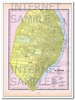
Original vintage 1886 Map of St Louis. MO. Steam Roads and Horse Roads are listed, streets are named. Also reference to Prominent Figures such as: City Hall, Court Houses, Union Market, Mercantile Library, Washington University, and more. Hotels are Barnum's, Hotel Barnum, Grand Central, Laciede, Lindell, Planters. Theaters are Apollo Gardens, DeBar's Opera House, Olympic, and Theatre Comique.
The map itself is not dated, but it was removed from an old Family Atlas published in 1886. Beautifully detailed hand colored 124+ year old antique map would look magnificent matted and framed! (Image has a slight pinkish tint due to scanner fault).
Approximate size 11 x 13.5 inches.
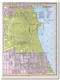
On the reverse side (see Additional Images tab) is the Map of CHICAGO, IL. Lists Steam Roads and Horse Roads on the Legend. All streets are labeled.
st louis missouri 1886 original hand colored antique city vintage map
- Product Code: p577b
- Length: 14 inches
- Width: 11 inches
- Pages: 1
- Views: 6
- Availability: In Stock
- $49.99
$37.49
ON SALE
25% OFF

