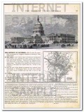
Original 1882 vintage Map of WEST VIRGINIA, VIRGINIA, SOUTH CAROLINA, and SOUTH CAROLINA. Contains WV. VA. SC. NC. Has 2 insets, one of the Vicinity of Charleston in the circular inset and Norfolk VA in the rectangular inset. This hand colored map was drawn by J. Wells of N.Y. and engraved by Oliver J. Stewart of N.Y. Printed by A.S. Barnes and Company of NY and Chicago. This 130+ year old antique steel engraving print would look sensational matted and framed.On the reverse side (see Additional Images tab) is a magnificent steel engraving titled THE CAPITAL AT WASHINGTON featuring the Capital Building in Washington, DC. Image size is approximately 8.5 x 4 inches. There is also an inset of the map of The District of Columbia.
west virginia north south carolina 1882 old hand colored vintage map
- Product Code: f923
- Length: 12 inches
- Width: 10 inches
- Pages: 1
- Views: 83
- Availability: In Stock
- $39.99
$29.99
ON SALE
25% OFF

