North America
Vintage North America Maps
Original vintage hand colored maps display wonderfully matted and framed. Unique old collectible antique Maps of North America. Alabama, Arizona, Utah, Baltimore Maryland, Boston Massachusetts, California, Canada, Central States East, West, Chicago and St. Louis, Cincinnati and Washington, DC, Colorado, Commercial Map of the United States, Florida and Alabama, Georgia and South Carolina, Indiana and Ohio, Iowa, Kansas and Nebraska, Louisiana, Maine New Hampshire and Vermont, Massachusetts Connecticut and Rhode Island, Michigan and Wisconsin, Middle Atlantic States, Minnesota, Mississippi, Arkansas, New England States, New Jersey, Pennsylvania, New Mexico, New York, Kentucky, Oregon, Pacific States, Quebec, South Carolina, Southern States, Territorial Growth of the US, Texas. Dates range from 1856, 1882 to 1886. Also Austin County Texas 1959 aerial survey for oil and gas maps.
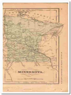
minnesota 1882 old mn original hand colored antique vintage map
Vintage original MAP OF MINNESOTA. This 1882 beautifully detailed hand colored map was drawn by J more. Wells of NY. and was Engraved by Oliver J. Stewart of NY. Printed by A.S. Barnes and Company of NY and Chicago. This 130+ year old antique MN map would look wonderful matted and framed! Page measures approx 5 x 10 inches. less
$29.99 $22.49
mississippi and louisiana 1886 la ms hand colored old vintage map
Original vintage 1886 Map of MISSISSIPPI. Lists the population at 1,131,597 more. Beautifully detailed hand colored copper engraved original map. LA. MS. The map itself is not dated, but was removed from a Family Atlas published in 1886. A true 123+ year old antique map. Would look magnificent when matted and framed!Page measures approximately 11 x 13.5 inches.On the reverse side (click Additional Images tab) is the Map of LOUISIANA, shown with a population of 939,946. less
$29.99 $22.49
mississippi louisiana arkansas 1882 hand colored antique vintage map
Vintage original Map of MISSISSIPPI, LOUISIANA and ARKANSAS more. This beautifully detailed hand colored MS. LA. AR. map was drawn by J. Wells of NY. and was engraved by Oliver J. Stewart of NY. Printed by A.S. Barnes and Company of NY and Chicago. This 1882 map would look sensational matted and framed. 130+ year old antique map. On the reverse side (see Additional Images tab) is a steel engraving titled RIVER AND TREES OF FLORIDA. FL. HOME OF THE ALLIGATOR by J.E. Palmer. less
$39.99 $29.99
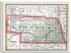
nebraska 1886 original hand colored antique state vintage map
Original vintage 1886 Map of NEBRASKA, with a population of 740,753 more. Beautifully detailed hand colored engraved original NE. state map. The map is not dated, but was removed from a Family Atlas published in 1886. A true 124+ year old antique map. Would look magnificent when matted and framed!Page measures approximately 11 x 13.5 inches. On the reverse side (see Additional Images tab) is the Map of KANSAS KS. less
$29.99 $22.49
new jersey pennsylvania de md 1882 hand colored antique vintage map
Original vintage Map of NEW JERSEY, PENNSYLVANIA, DELAWARE and MARYLAND more. Has a fantastic detailed inset of the Vicinity of Philadelphia. This beautifully detailed 130+ year old hand colored map was drawn by J. Wells of N.Y. and engraved by Oliver J. Stewart of N.Y. Printed by A.S. Barnes and Company of NY and Chicago. Old 1882 map of NJ. PA. DE. and MD. Would look wonderful matted and framed. A true antique. less
$39.99 $29.99
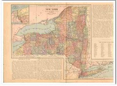
new york 1886 geographical statistics and antique color vintage map
Original vintage 1886 map of NEW YORK and geographical statistics more. The detailed, colored antique map covers two pages. It would matte and frame beautifully. There are engraved scenes on the reverse side. There are many geographical statistics and details. Also included is a color Map of New York City and Vicinity measuring 6 by 5 inches. It shows Long Island, Brooklyn, Queens, Staten Island, Jersey City, New York City, Yonkers, and more. less
$45.00 $33.75
north america 1856 hand colored antique usa canada vintage map
Original vintage MAP OF NORTH AMERICA Engraved To Illustrate Mitchell's School and Family Geography more. The reverse side of the map is blank. This original 153 year old antique hand colored map has foxing due to age. It would look marvelous matted and framed.Approximate size 9 x 12 inches. less
$49.99 $37.49
north america 1882 usa canada mexico cuba hand colored vintage map
Original vintage Map of NORTH AMERICA. The map contains United States, Canada, Alaska, Greenland, Iceland, Mexico, Belize (spelled Balize), Panama and Central America more. Cuba, Jamaica and many West Indies islands are labeled. This beautiful hand colored map was drawn by J. Wells of N.Y. and was engraved by Oliver J. Stewart of N.Y. Printed by A.S. Barnes and Company of NY and Chicago. This 130+ year old antique 1882 map would look fabulous matted and framed. less
$39.99 $29.99
north america 1886 original old antique color physical vintage map
Original vintage 1886 color Physical Map of NORTH AMERICA. Nicely detailed, this old antique map would display beautifully matted and framed more. less
$45.00 $33.75
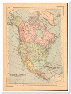
north america 1886 original old antique color political vintage map
Original vintage 1886 color Political Map of NORTH AMERICA. Nicely detailed, this 120 years old antique map would display beautifully matted and framed more. Also included on the reverse side and second page (see Additional Images tab) are steel engravings of Plants of North America, and Animals of North America including moose and wolves, Alaskan Fur Seals, Wild Turkey and more. less
$45.00 $33.75
nova scotia new brunswick and quebec 1886 old vintage maps
Original vintage 1886 Map of NOVA SCOTIA and NEW BRUNSWICK, Population was listed at 285,594 for New Brunswick more. Nova Scotia at 387,800. Beautifully detailed hand colored copper engraved original map. The map is not dated, but was removed from a Family Atlas published in 1886. A true 123+ year old antique map. Would look magnificent when matted and framed!Page measures approximately 11 x 13.5 inches.On the reverse side (click Additional Images tab) is the Map of QUEBEC. less
$29.99 $22.49
ohio indiana kentucky 1882 oh in ky hand colored antique vintage map
Original vintage Map of OHIO, INDIANA and KENTUCKY. Contains OH more. IN. and KY. Has a detailed circular inset of the city of Cincinnati, OH on the left side. This 130+ year old antique hand colored, steel engraving map was drawn by J. Wells of N.Y. and was engraved by Oliver J. Stewart of N.Y. Printed by A.S. Barnes and Company of NY and Chicago. Map would look fabulous matted and framed! A true antique. On the reverse side (see Additional Images tab) are steel engravings of A VIEW IN THE SOUTHERN STATE. A COTTON FIELD featuring negro m less
$39.99 $29.99
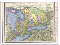
ontario 1886 canada hand colored antique vintage map
Original vintage Map of ONTARIO Canada, Beautifully detailed 123+ year old antique map more. The map itself is not dated, but it was removed from a Family Atlas published in 1886. It would look magnificent matted and framed!Approximate size 11 x 13.5 inches. less
$29.99 $22.49
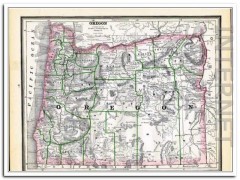
oregon territory 1886 original hand colored antique vintage map
Original vintage 1886 Map of OREGON TERRITORY. Lists the population at 174,768 more. Beautifully detailed hand colored copper engraved original map. The map itself is not dated, but was removed from a Family Atlas published in 1886. A true 123+ year old antique map. OR. WA. Would look magnificent when matted and framed! "The Territory of Oregon was an organized incorporated territory of the United States that existed from August 14, 1848 until February 14, 1859, when the southwestern portion of the territory was admitted to the Union as the St less
$29.99 $22.49
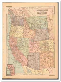
pacific states 1886 wa or ca nv az nm co ut id wy mt color vintage map
Original vintage 1886 Map of PACIFIC STATES AND THE TERRITORIES more. WA OR CA NV AZ NM CO UT ID WY MT Washington, Oregon, California, Nevada, Arizona, New Mexico, Colorado, Utah, Idaho, Wyoming, Montana. Has an insert Vicinity of San Francisco, CA. On the reverse side (see Additional Images tab) is an engraving of Geysers and Fire Basins in The Rocky Mountains by John Karst. Nicely detailed, this antique map would matte and frame beautifully. There is a small tear on the bottom edge that will not affect display. less
$36.00 $27.00
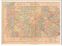
pennsylvania 1886 original hand colored antique state vintage map
Original vintage 1886 gatefold Map of PENNSYLVANIA. Beautifully detailed hand colored engraved map more. The map itself is not dated, but was removed from an Atlas published in 1886. The seam at the fold has a two inch split, but will matte out nicely. An exquisite original 120+ year old antique map. Would display magnificently when matted and framed! Approximate size 20 x 10 inches. less
$45.99 $34.49
