North America
Vintage North America Maps
Original vintage hand colored maps display wonderfully matted and framed. Unique old collectible antique Maps of North America. Alabama, Arizona, Utah, Baltimore Maryland, Boston Massachusetts, California, Canada, Central States East, West, Chicago and St. Louis, Cincinnati and Washington, DC, Colorado, Commercial Map of the United States, Florida and Alabama, Georgia and South Carolina, Indiana and Ohio, Iowa, Kansas and Nebraska, Louisiana, Maine New Hampshire and Vermont, Massachusetts Connecticut and Rhode Island, Michigan and Wisconsin, Middle Atlantic States, Minnesota, Mississippi, Arkansas, New England States, New Jersey, Pennsylvania, New Mexico, New York, Kentucky, Oregon, Pacific States, Quebec, South Carolina, Southern States, Territorial Growth of the US, Texas. Dates range from 1856, 1882 to 1886. Also Austin County Texas 1959 aerial survey for oil and gas maps.
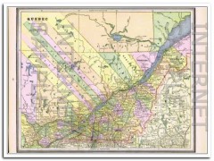
quebec 1886 original hand colored antique canada province vintage map
Original vintage Map of QUEBEC. Beautifully detailed hand colored copper engraved map more. The map itself is not dated, but was removed from a Family Atlas published in 1886. A true 124+ year old antique map. Would display magnificently when matted and framed!Page measures approximately 11 x 13.5 inches.On the reverse side (click Additional Images tab) is the 1886 Map of NOVA SCOTIA and NEW BRUNSWICK. The population was listed at 285,594 for New Brunswick, and Nova Scotia was 387,800. less
$29.99 $22.49
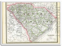
south carolina 1886 original hand colored antique state vintage map
Original vintage Map of SOUTH CAROLINA, shown with a population of 995,577 more. Beautifully detailed hand colored copper engraved map. The map is not dated, but was removed from a Family Atlas published in 1886. A true 124+ year old antique map. Would look magnificent when matted and framed!Page measures approximately 11 x 13.5 inches.On the reverse side (click Additional Images tab) is the 1886 Map of GEORGIA. Population listed at 1,542,180 at time of printing. less
$29.99 $22.49
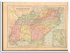
southern states east 1886 wv va tn nc sc ga al ms ky color vintage map
Original vintage 1886 color Map of SOUTHERN STATES EASTERN DIVISION more. WV VA TN NC SC GA AL MS KY W Virgina, Tennessee North Carolina, South Carolina, Alabama, Mississippi, Kentucky. Map inset of Southern Florida. On the reverse side (see Additional Images tab) is an engraving titled Picking Cotton. Nicely detailed, this antique map would display beautifully matted and framed. less
$35.00 $26.25
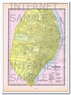
st louis missouri 1886 original hand colored antique city vintage map
Original vintage 1886 Map of St Louis. MO. Steam Roads and Horse Roads are listed, streets are named more. Also reference to Prominent Figures such as: City Hall, Court Houses, Union Market, Mercantile Library, Washington University, and more. Hotels are Barnum's, Hotel Barnum, Grand Central, Laciede, Lindell, Planters. Theaters are Apollo Gardens, DeBar's Opera House, Olympic, and Theatre Comique.The map itself is not dated, but it was removed from an old Family Atlas published in 1886. Beautifully detailed hand colored 124+ year old antique map would look magnificent matte less
$49.99 $37.49
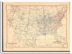
standard time 1886 as adopted by the railways of the usa vintage map
Original vintage 1886 MAP OF STANDARD TIME as Adopted By The Railways Of The United States, by W more.J. Allen. Nicely detailed, this antique map would display beautifully matted and framed. less
$45.00 $33.75
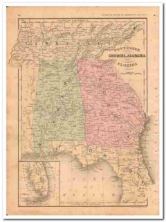
tennessee georgia alabama florida 1882 hand colored vintage map
Original vintage Map of TENNESSEE GEORGIA ALABAMA and FLORIDA more. Contains TN, GA, AL, and FL. Has a great detailed inset of southern Florida. This beautifully detailed hand colored map was drawn by J. Wells of N.Y. and was engraved by Oliver J. Stewart of N.Y. Printed by A.S. Barnes and Company of NY and Chicago. Steel engraving printed map in 1886. A true 120+ year old antique map. Would look sensational matted and framed! less
$39.99 $29.99
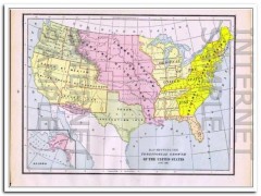
territorial growth of united states 1886 original antique vintage map
Original vintage Map Showing The TERRITORIAL GROWTH OF UNITED STATES, This beautifully detailed hand colored map itself is not dated, but it was removed from a Family Atlas published in 1886, indexed in 1887 more. 123+ years old. Would look magnificent matted and framed!Approximate size: 11 x 13.5 inches. less
$24.99 $18.74
united states 1886 original antique old color physical vintage map
Original vintage 1886 color Physical Map of THE UNITED STATES more. Also shown is Section of The United States Between the Pacific Ocean and The Atlantic Ocean. Map has foxing in lower left corner. Nicely detailed, this 120+ years old antique map would display beautifully matted and framed. less
$30.00 $22.50
united states 1886 populations original antique commercial vintage map
Original vintage 1886 color Commercial Map of THE UNITED STATES more. There is a list of the Principal Railroads in The United States. Shown are Principal Forest Region, Wheat, Rye, Corn, Cotton, Pasture, Mineral, Steam Ship Routes, and Canals. Nicely detailed, this antique map would matte and frame beautifully. On the reverse side is a Reference Table of Population of Cities, Towns, Villages and Boroughs having a Population of Over 10,000 by the Census of 1880. less
$30.00 $22.50
utah 1886 original hand colored antique state vintage map
Original vintage Map of UTAH, with a population of 143,963 at time of map publication more. Beautifully detailed hand colored copper engraved original state map. The map is not dated, but was removed from a Family Atlas published in 1886. A true 124+ year old antique map. Would look magnificent when matted and framed!Page measures approximately 11 x 13.5 inches.On the reverse side (click Additional Images tab) is the 1886 Map of ARIZONA. Population listed at 40,440. less
$29.99 $22.49
washington and oregon 1886 original hand colored antique vintage map
Original vintage 1886 Map of WASHINGTON TERRITORY, Lists the population at 75,118 more. Beautifully detailed hand colored copper engraved original map. The map is not dated, but was removed from a Family Atlas published in 1886. A true 123+ year old antique map. Would look magnificent when matted and framed!Page measures approximately 11 x 13.5 inches.On the reverse side (see Additional Images tab) is a Map of OREGON TERRITORY, with a population of 174,768. less
$29.99 $22.49
washington oregon idaho nevada utah arizona 1882 hand colored old map
Original 1882 vintage Map of WASHINGTON, OREGON, IDAHO, NEVADA, UTAH, and ARIZONA more. WA OR ID NV UT AZ. This beautifully detailed hand colored map was drawn by J. Wells of N.Y. and engraved by Oliver J. Stewart of N.Y. Printed by A.S. Barnes and Company of NY and Chicago. This 130+ year old steel engraving print would look sensational matted and framed. A true antique. less
$39.99 $29.99
west virginia north south carolina 1882 old hand colored vintage map
Original 1882 vintage Map of WEST VIRGINIA, VIRGINIA, SOUTH CAROLINA, and SOUTH CAROLINA more. Contains WV. VA. SC. NC. Has 2 insets, one of the Vicinity of Charleston in the circular inset and Norfolk VA in the rectangular inset. This hand colored map was drawn by J. Wells of N.Y. and engraved by Oliver J. Stewart of N.Y. Printed by A.S. Barnes and Company of NY and Chicago. This 130+ year old antique steel engraving print would look sensational matted and framed.On the reverse side (see Additional Images tab) is a magnificent steel engraving titled THE CAPITAL AT WASHINGTON feat less
$39.99 $29.99
