Maps
Vintage Maps
Refine search and select category.
Refine Search
germany switzerland 1856 mitchells engraved hand colored vintage map
Original vintage hand colored MAP OF GERMANY, SWITZERLAND, AND NORTHERN ITALY more. Engraved to Illustrate Mitchell's School and Family Geography. Prussia, Austria, Bavaria. German States, Rank and Capitals are listed on a chart on the right upper side. Original map, printed in 1856, has foxing due to age. This 155 year old map is a true antique and would display fabulous matted and framed. less
$55.00 $41.25
germany switzerland 1882 steel engraving hand colored vintage map
Original vintage Map of GERMANY and SWITZERLAND. This beautifully detailed hand colored map was drawn by J more. Wells of N.Y. and was Engraved by Oliver J. Stewart of N.Y. Printed by A.S. Barnes and Company of NY and Chicago. Old 1882 (127+ yrs old) antique steel engraving map. Would look sensational matted and framed. Page measures 10 x 12 inches. less
$39.99 $29.99
great britain ireland 1856 mitchells engraved hand colored vintage map
Original vintage hand colored MAP OF GREAT BRITAIN AND IRELAND more. Engraved to Illustrate Mitchell's School and Family Geography. Scotland and Wales are also shown Original map, printed in 1856, has foxing due to age. This 160+ year old map is a true antique and would look fabulous matted and framed. less
$59.99 $44.99
highlands lowlands 1882 hand colored volcanoes isothermal vintage map
Original vintage 1882 Map of the Chart of the HIGHLANDS & LOWLANDS of the Earth, more. Principal Volcanoes and Isothermal Lines. Has a great inset of a worldwide Wind Chart. This beautifully detailed hand colored steel engraving map was drawn by J. Wells of N.Y. and was Engraved by Oliver J. Stewart of N.Y. Printed by A.S. Barnes and Company of NY and Chicago. This 130+ year old antique map would look marvelous matted and framed. On the reverse side (see Additional Images tab) is a steel engraving of SCENERY IN MALAYSIA featuring huts, tropical palm trees, and natives. less
$35.99 $26.99
kansas and nebraska 1886 ks ne hand colored vintage map
Original vintage 1886 Map of KANSAS. The population is not listed more. Beautifully detailed hand colored copper engraved original map. KS. NE. The map is not dated, but was removed from a Family Atlas published in 1886. A true 123+ year old antique map. Would look magnificent when matted and framed!Page measures approximately 11 x 13.5 inches.On the reverse side (see Additional Images tab) is the Map of NEBRASKA, with a population of 740,753. less
$29.99 $22.49
louisiana 1886 original hand colored antique state vintage map
Original vintage Map of LOUISIANA, shown with a population of 939,946 more. Beautifully detailed hand colored engraved original state map. LA. MS. The map itself is not dated, but was removed from a Family Atlas published in 1886. A true 124+ year old antique map. Would look magnificent when matted and framed!Page measures approximately 11 x 13.5 inches.On the reverse side (click Additional Images tab) is the Map of MISSISSIPPI. Lists the population at 1,131,597 less
$29.99 $22.49
maine new hampshire vermont 1882 hand colored antique vintage map
Original vintage Map of MAINE, NEW HAMPSHIRE, and VERMONT from 1882 more. This hand colored beautifully detailed steel engraving map was drawn by J. Wells of N.Y. and was engraved by Oliver J. Stewart of N.Y. Printed by A.S. Barnes and Company of NY and Chicago. This original 130+ year old map would look sensational matted and framed. ME. NH. VT. 1882 antique map. less
$39.99 $29.99
massachusetts connecticut rhode island 1882 antique hand colored map
Original vintage antique Map of MASSACHUSETTS, CONNECTICUT, and RHODE ISLAND more. The map contains MA. CT. RI. and Long Island, NY. Has a great inset of The Vicinity of Boston. Drawn by J. Wells of N.Y. and was engraved by Oliver J. Stewart of N.Y. Printed by A.S. Barnes and Company of NY and Chicago. . This beautifully detailed,127 year old hand colored steel engraving map would look fantastic matted and framed. 1882 MA CT RI. less
$39.99 $29.99
mexico central america west indies 1856 hand colored vintage map
Original vintage hand colored MAP OF MEXICO, CENTRAL AMERICA, AND THE WEST INDIES Engraved To Illustrate Mitchell's School and Family Geography more. There is an insert at the top of the page with The Isthmus or Tehuantepec Showing the Proposed Route from the Gulf Of Mexico to the Pacific Ocean. There is also an insert on the bottom left of The Isthmus or Nicaragua showing the Proposed Routes from The Caribbean Sea to the Pacific Ocean. The West Indies comprise the Great Antilles, the Little Antilles, the Bahama Islands, and the Caribbee Islands. The Great Antilles are Cuba, Haiti, Jamaica, and Porto less
$62.99 $47.24
michigan wisconsin original 1856 hand colored antique vintage map
Original vintage hand colored Map of The States of MICHIGAN and WISCONSIN Engraved To Illustrate Mitchell's School and Family Geography more. The reverse side of the map is blank. This 150+ year old original map has foxing due to age. Beautifully detailed antique map would look marvelous matted and framed. Original 1856 MI. WI. map. less
$75.99 $56.99
middle atlantic states 1886 ny pa nj de md antique color vintage map
Original vintage 1886 color Map of MIDDLE ATLANTIC STATES. NY more. PA. NJ. DE. MD. New York, New Jersey, Pennsylvania, Delaware, Maryland. Insets of Vicinity of Philadelphia, PA and Trenton NJ, and Vicinity of New York. Nicely detailed, this antique map would display beautifully matted and framed. On the reverse side is an engraving titled Commerce in The Middle States , showing tall ships in the harbor. less
$35.00 $26.25
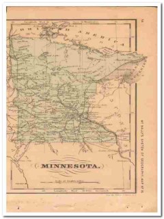
minnesota 1882 old mn original hand colored antique vintage map
Vintage original MAP OF MINNESOTA. This 1882 beautifully detailed hand colored map was drawn by J more. Wells of NY. and was Engraved by Oliver J. Stewart of NY. Printed by A.S. Barnes and Company of NY and Chicago. This 130+ year old antique MN map would look wonderful matted and framed! Page measures approx 5 x 10 inches. less
$29.99 $22.49
mississippi and louisiana 1886 la ms hand colored old vintage map
Original vintage 1886 Map of MISSISSIPPI. Lists the population at 1,131,597 more. Beautifully detailed hand colored copper engraved original map. LA. MS. The map itself is not dated, but was removed from a Family Atlas published in 1886. A true 123+ year old antique map. Would look magnificent when matted and framed!Page measures approximately 11 x 13.5 inches.On the reverse side (click Additional Images tab) is the Map of LOUISIANA, shown with a population of 939,946. less
$29.99 $22.49
mississippi louisiana arkansas 1882 hand colored antique vintage map
Vintage original Map of MISSISSIPPI, LOUISIANA and ARKANSAS more. This beautifully detailed hand colored MS. LA. AR. map was drawn by J. Wells of NY. and was engraved by Oliver J. Stewart of NY. Printed by A.S. Barnes and Company of NY and Chicago. This 1882 map would look sensational matted and framed. 130+ year old antique map. On the reverse side (see Additional Images tab) is a steel engraving titled RIVER AND TREES OF FLORIDA. FL. HOME OF THE ALLIGATOR by J.E. Palmer. less
$39.99 $29.99
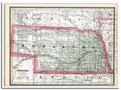
nebraska 1886 original hand colored antique state vintage map
Original vintage 1886 Map of NEBRASKA, with a population of 740,753 more. Beautifully detailed hand colored engraved original NE. state map. The map is not dated, but was removed from a Family Atlas published in 1886. A true 124+ year old antique map. Would look magnificent when matted and framed!Page measures approximately 11 x 13.5 inches. On the reverse side (see Additional Images tab) is the Map of KANSAS KS. less
$29.99 $22.49
new jersey pennsylvania de md 1882 hand colored antique vintage map
Original vintage Map of NEW JERSEY, PENNSYLVANIA, DELAWARE and MARYLAND more. Has a fantastic detailed inset of the Vicinity of Philadelphia. This beautifully detailed 130+ year old hand colored map was drawn by J. Wells of N.Y. and engraved by Oliver J. Stewart of N.Y. Printed by A.S. Barnes and Company of NY and Chicago. Old 1882 map of NJ. PA. DE. and MD. Would look wonderful matted and framed. A true antique. less
$39.99 $29.99


