Maps
Vintage Maps
Refine search and select category.
Refine Search
south africa 1886 cape colony zulu land hand colored vintage map
Original vintage 1886 Map of SOUTH AFRICA. Cape Colony Zulu Land more.Click on the image to view Zoom In Closeup photo of the details. The map itself is not dated, but it was removed from an old Family Atlas published in 1886. Beautifully detailed, this 120+ year old hand colored map would look magnificent framed and matted!Approximate size 11 x 14 inches. less
$49.99 $37.49
south america 1856 mitchells hand colored engraved antique vintage map
Original vintage hand colored MAP OF SOUTH AMERICA Engraved to Illustrate Mitchell's School and Family Geography more. There is also an inset of the Isthmus of Darien Showing the route of the Railroad from Aspinwall to Panama. Countries include Brazil, Venezuela, Chile, Bolivia, Peru, Guiana, Granada, Ecuador, Paraguay, Uruguay. Original map, printed in 1856, has foxing due to age. This 155 year old map is a true antique and would look marvelous matted and framed. less
$65.00 $48.75
south america 1886 engravings original antique physical vintage map
Original vintage 1886 color Physical Map of SOUTH AMERICA. Nicely detailed, this antique map would matte and frame beautifully more. On the reverse side is a beautifully detailed steel engraving of the Plants of South America. less
$30.00 $22.50
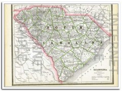
south carolina 1886 original hand colored antique state vintage map
Original vintage Map of SOUTH CAROLINA, shown with a population of 995,577 more. Beautifully detailed hand colored copper engraved map. The map is not dated, but was removed from a Family Atlas published in 1886. A true 124+ year old antique map. Would look magnificent when matted and framed!Page measures approximately 11 x 13.5 inches.On the reverse side (click Additional Images tab) is the 1886 Map of GEORGIA. Population listed at 1,542,180 at time of printing. less
$29.99 $22.49
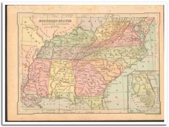
southern states east 1886 wv va tn nc sc ga al ms ky color vintage map
Original vintage 1886 color Map of SOUTHERN STATES EASTERN DIVISION more. WV VA TN NC SC GA AL MS KY W Virgina, Tennessee North Carolina, South Carolina, Alabama, Mississippi, Kentucky. Map inset of Southern Florida. On the reverse side (see Additional Images tab) is an engraving titled Picking Cotton. Nicely detailed, this antique map would display beautifully matted and framed. less
$35.00 $26.25
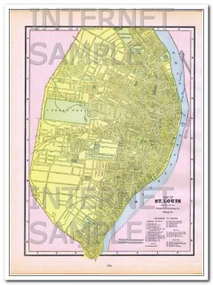
st louis missouri 1886 original hand colored antique city vintage map
Original vintage 1886 Map of St Louis. MO. Steam Roads and Horse Roads are listed, streets are named more. Also reference to Prominent Figures such as: City Hall, Court Houses, Union Market, Mercantile Library, Washington University, and more. Hotels are Barnum's, Hotel Barnum, Grand Central, Laciede, Lindell, Planters. Theaters are Apollo Gardens, DeBar's Opera House, Olympic, and Theatre Comique.The map itself is not dated, but it was removed from an old Family Atlas published in 1886. Beautifully detailed hand colored 124+ year old antique map would look magnificent matte less
$49.99 $37.49
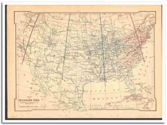
standard time 1886 as adopted by the railways of the usa vintage map
Original vintage 1886 MAP OF STANDARD TIME as Adopted By The Railways Of The United States, by W more.J. Allen. Nicely detailed, this antique map would display beautifully matted and framed. less
$45.00 $33.75
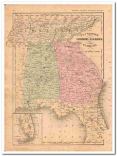
tennessee georgia alabama florida 1882 hand colored vintage map
Original vintage Map of TENNESSEE GEORGIA ALABAMA and FLORIDA more. Contains TN, GA, AL, and FL. Has a great detailed inset of southern Florida. This beautifully detailed hand colored map was drawn by J. Wells of N.Y. and was engraved by Oliver J. Stewart of N.Y. Printed by A.S. Barnes and Company of NY and Chicago. Steel engraving printed map in 1886. A true 120+ year old antique map. Would look sensational matted and framed! less
$39.99 $29.99
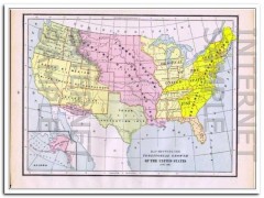
territorial growth of united states 1886 original antique vintage map
Original vintage Map Showing The TERRITORIAL GROWTH OF UNITED STATES, This beautifully detailed hand colored map itself is not dated, but it was removed from a Family Atlas published in 1886, indexed in 1887 more. 123+ years old. Would look magnificent matted and framed!Approximate size: 11 x 13.5 inches. less
$24.99 $18.74
the world in hemispheres 1886 original antique old color vintage map
Original vintage 1886 color Map of THE WORLD IN HEMISPHERES. Nicley detailed, this 120+ years old antique map would display beautifully matted and framed more. less
$28.00 $21.00
united states 1886 original antique old color physical vintage map
Original vintage 1886 color Physical Map of THE UNITED STATES more. Also shown is Section of The United States Between the Pacific Ocean and The Atlantic Ocean. Map has foxing in lower left corner. Nicely detailed, this 120+ years old antique map would display beautifully matted and framed. less
$30.00 $22.50
united states 1886 populations original antique commercial vintage map
Original vintage 1886 color Commercial Map of THE UNITED STATES more. There is a list of the Principal Railroads in The United States. Shown are Principal Forest Region, Wheat, Rye, Corn, Cotton, Pasture, Mineral, Steam Ship Routes, and Canals. Nicely detailed, this antique map would matte and frame beautifully. On the reverse side is a Reference Table of Population of Cities, Towns, Villages and Boroughs having a Population of Over 10,000 by the Census of 1880. less
$30.00 $22.50
utah 1886 original hand colored antique state vintage map
Original vintage Map of UTAH, with a population of 143,963 at time of map publication more. Beautifully detailed hand colored copper engraved original state map. The map is not dated, but was removed from a Family Atlas published in 1886. A true 124+ year old antique map. Would look magnificent when matted and framed!Page measures approximately 11 x 13.5 inches.On the reverse side (click Additional Images tab) is the 1886 Map of ARIZONA. Population listed at 40,440. less
$29.99 $22.49
washington and oregon 1886 original hand colored antique vintage map
Original vintage 1886 Map of WASHINGTON TERRITORY, Lists the population at 75,118 more. Beautifully detailed hand colored copper engraved original map. The map is not dated, but was removed from a Family Atlas published in 1886. A true 123+ year old antique map. Would look magnificent when matted and framed!Page measures approximately 11 x 13.5 inches.On the reverse side (see Additional Images tab) is a Map of OREGON TERRITORY, with a population of 174,768. less
$29.99 $22.49
washington oregon idaho nevada utah arizona 1882 hand colored old map
Original 1882 vintage Map of WASHINGTON, OREGON, IDAHO, NEVADA, UTAH, and ARIZONA more. WA OR ID NV UT AZ. This beautifully detailed hand colored map was drawn by J. Wells of N.Y. and engraved by Oliver J. Stewart of N.Y. Printed by A.S. Barnes and Company of NY and Chicago. This 130+ year old steel engraving print would look sensational matted and framed. A true antique. less
$39.99 $29.99
west virginia north south carolina 1882 old hand colored vintage map
Original 1882 vintage Map of WEST VIRGINIA, VIRGINIA, SOUTH CAROLINA, and SOUTH CAROLINA more. Contains WV. VA. SC. NC. Has 2 insets, one of the Vicinity of Charleston in the circular inset and Norfolk VA in the rectangular inset. This hand colored map was drawn by J. Wells of N.Y. and engraved by Oliver J. Stewart of N.Y. Printed by A.S. Barnes and Company of NY and Chicago. This 130+ year old antique steel engraving print would look sensational matted and framed.On the reverse side (see Additional Images tab) is a magnificent steel engraving titled THE CAPITAL AT WASHINGTON feat less
$39.99 $29.99


